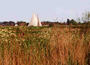
The Norfolk Broads
Roughly two thirds of all the holidays taken on our waterways use over 2500 miles of interconnected rivers and canals. The other third of boating holidays takes place within these Norfolk and Suffolk Broads. Open sky, distant horizons, reed swamps, village ‘staithes’, waterside pubs and car inaccessible backwaters make water-borne exploration very rewarding.
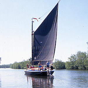
Restored Wherry Albion
East Anglia is home to the Broads. Five rivers, the Ant, Bure, Chet, Thurne and Waveney, slowly wander through marshland towards an eroding coast. Formerly, peat was dug from behind the riverbanks to supply the hearths of Norwich (1000s – 1400s). The diggings were abandoned then became flooded and formed ‘The Broads’. Some are silting up and slowly returning to mixed woodland via reedbeds, fen and carr.
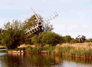
Huge pumps harnessed the wind to drain the peat which then became rich farmland but also shrank. About a third of the Broad Authority’s area is below sea level. Only riverbanks stop flooding of the area. Wind encouraged tides sweeping in from the North Sea have been known to break through.
The area is now park of the Norfolk Broads National Park and is Britain largest protected wetland.

ON THESE WATERWAYS…
Potter Heigham Bridge is 700 years old with a limited clearance. Although it’s 17 miles upstream from the sea an understanding of tides is essential here. A pilot assists hire boats through as tidal movement can be two feet on a nominal seven feet clearance. How Hill, Ludham is an educational centre with access around the estate showing ‘Broads in microcosm’ – reed, sedge, carr, marshman’s thatched cottage, clear open water and marsh meadows. Oulton Broad is home to the oldest power boat club in the country. Water sport schools abound. Windsurfing, canoeing, sailing are all available. Breydon Water is the remains of a river estuary, very shallow except in the dredged channel with a fast running tidal stream from Great Yarmouth. Hickling Broad (Norfolk Wildlife Trust) is a nature reserve and has Coot, moorhen, butterflies in abundance which can be viewed from the water trail boat trip on a replica reed lighter. Together with nearby Horsey Mere it makes a huge area devoted primarily to wildlife.
Broads cruising is different to canal cruising! The Broads are tidal unlike canals, so water levels change twice a day. This affects cruising. Mooring is often to pontoons. There are a few bridges can only be negotiated on low tides. The further from the sea, the less the effect of tides. So, most Broads waterways are shallow and tranquil. But, in general Norfolk Broads boating is easy! A Broads holiday is a great way to explore the picturesque villages.
The boats are different too. Most are either cruisers or yachts or open day boats, with an increasing number of electric craft. However there are plenty of firms offing boat hire. The only access to the Broads is from the sea at Great Yarmouth or Lowestoft so few canal based narrowboats risk the tricky sea voyage.
The Broads Authority provides much needed management to achieve balance between conservation, recreation and navigation. Competition between wildlife in the fens and marshes and human activity, e.g. sailing, walking, canoeing, windsurfing, etc, is intense. Strict speed restrictions for boats are enforced as banks could be undermined by their wash.

All materials and images © Canal Junction Ltd. Dalton House, 35 Chester St, Wrexham LL13 8AH. No unauthorised reproduction.
About | Terms | Privacy| Refunds & Returns| Sitemap | Contact Us
With over 800 pages, this website uses cookies to record visitor behaviour using Google Analytics. More information on Privacy Page. Page last updated: 13/05/2024.
Back to Menu....
Canal Maps & Guides >>